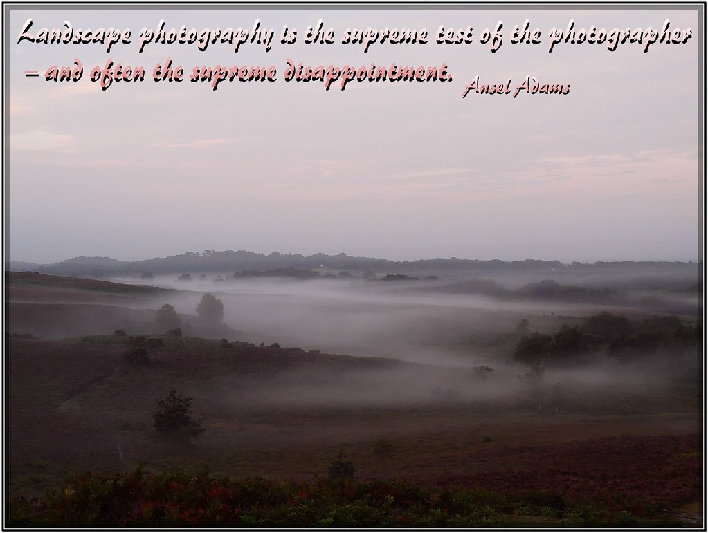
Friday 29 March 2013

Creative Challenge 244 - ATTENTION TO DETAIL

Z0106763

Hi all Happy Easter

Hi all Happy Easter everybody. I am not around much at the moment its the coldest, wettest, snowiest spring on record here in the UK I think my muse has gone south until the Summer LOL


Z0260931ccccc

Sunday 24 March 2013

Have a great Sunday

HI ALL SORRY i HAVE NOT BEEN AROUND MUCH THE LAST WEEK i GOT LAID LOW WITH A BAD STOMACH BUG BUT FEELING MUCH BETTER NOW WILL CATCH UP OVER THE NEXT FEW DAYS;)

Tuesday 19 March 2013

Sunday 10 March 2013

Wednesday 6 March 2013

Happy Birthday to a very special Friend

Happy Birthday Danette, Mom sends her Love and Best Wishes;)
Z0060001

View from the Edge: Hengistbury Head, Dorset, England.

Hengistbury Head is a sandstone headland which forms part of Southbourne, the most easterly part of the Borough of Bournemouth, Dorset.
Hengistbury Head forms the southern boundary of Christchurch Harbour. The sand bar at the end of the Head is the main feature closing the harbour from the south, while a peninsula at Mudefordcloses the harbour from the north.
The name
The region was originally named Hynesbury Head. However, after the discovery of the Iron Age artifacts–and in apparent confusion over a reference to the area as Hedenesburia–it was renamed Hengistbury Head after the Jutish king Hengest
Stone Age
Long prior to this, the site was occupied during the Upper Palaeolithic. There is evidence of an open settlement of the Creswellian culture on the hill in the middle of the headland dating to around 10,500 BC. At the time, this hill would have overlooked a large river valley that was to become the English Channel. Later, once the sea had inundated the surrounding valley, Mesolithic hunter gatherers exploited the site and Neolithic stone tools have been found but it was not until the Bronze Age that visible traces of the site's occupation are apparent.
Bronze Age
Eleven Bronze Age round barrows sit on the promontory with two more a little further inland. Numerous finds including Early Bronze Age axes, along with amber and gold jewellery were recovered from these monuments. Pottery found nearby to the barrows also indicates visitation during 1700-1400 BC. In around 700 BC, a small settlement to the very north of the headland was established; also around this time, the headland was cut off from the mainland by the construction of two banks and ditches. These earthworks turned Hengistbury Head into a fortified settlement area which seems to have grown over succeeding centuries until it became an important port.
The barrows at the site were first excavated by J. P. Bushe-Fox between 1911 and 1912 and then by Harold St George Gray in the years following the First World War. Most of our knowledge of the site comes from Barry Cunliffe's work there between 1979 and 1984.
Iron Age
One side of the Head is defended by large earthworks, called the "double dykes", similar to those found at Maiden Castle. These date to approximately 700 BC Due to the high concentration of iron ore in the area, this location became a significant trading port, trading worked metal–iron, silver, and bronze–with the Continent in return for wine, tools, and pottery. Many coins have been found from this period (making it one of the few areas in pre-Roman Britain to use coins). Interestingly, some of them were fake–worthless cores dipped in silver.
The Iron Age port at Hengistbury Head forms a final site in a small chain of fortified earthworks, starting from Hambledon Hill, and also including Hod Hill, Spetisbury Rings, Buzbury Rings, Badbury Rings and Dudsbury Camp.
Roman occupation
Under the Romans, Hengistbury Head was initially left alone, possibly as a result of its distance from Roman centres of power. However, as Roman rule expanded, trade was moved away from the Head to other Roman ports. Consequently, the region saw a decline in prosperity, and indeed, by about the time the Romans left (c.410 AD), the area was abandoned.
Medieval use
The area was not substantially reoccupied until Alfred the Great decided to rebuild the harbour as a defence against raiders. He built the town that later became Christchurch, on the north side of the harbour. Access to Salisbury up the River Avon made this a more strategic place. The Head may have been used for harbour defense at this time.

Find more photos like this on muzenews